The Scenic Splendor Series – Rivers
Update:
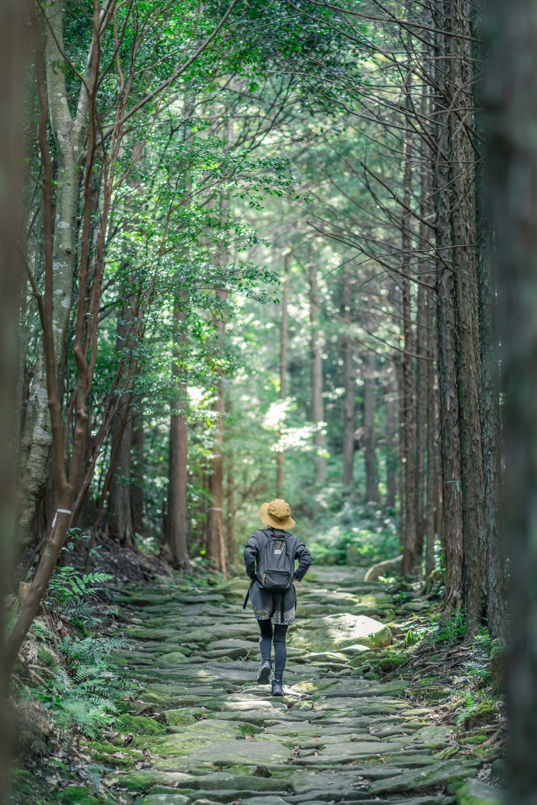
Kihoku Town
Kumano City
Kiho Town
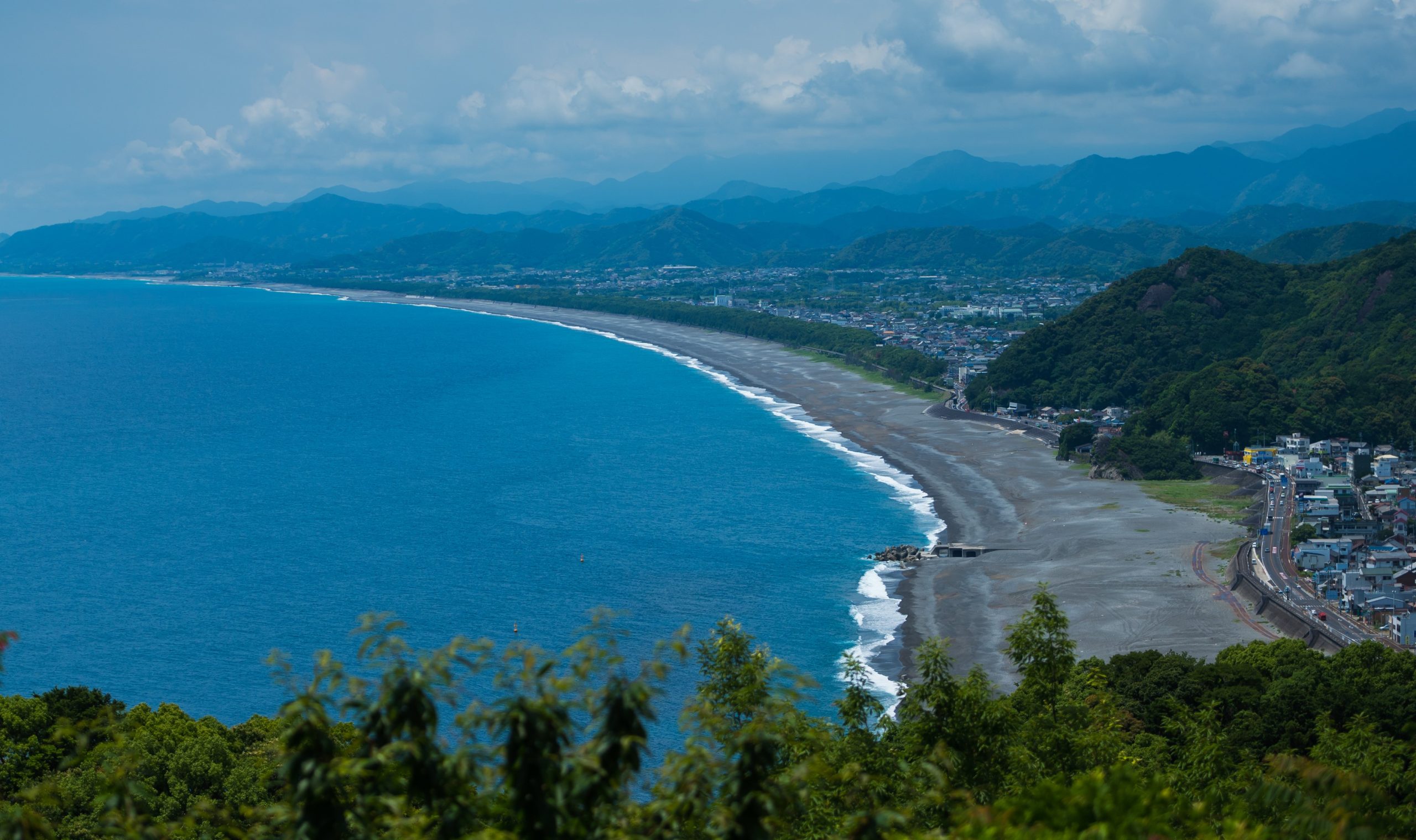
Flowing from the heart of the Odaiyama mountain, the river of Higashikishu cascades down the valley as a stream—occasionally transforming into a waterfall—before finally emptying into the Kumano-nada.
The pristine waters of this river are an important source of drinking water for local residents and also serve as a playground for leisure activities.
We will introduce five distinct river spots, each with its own unique history and features.
These include the Choshi-gawa River, known as the “Miracle River” due to its high level of transparency; the Doro-kyo Gorge of the Kitayama-gawa River, a stunningly beautiful valley; the Nunobiki-no-taki Falls, a tranquil waterfall that flows through a deep valley; the Kumano-gawa River, once a Kawa-no-Sankeimichi (River Pilgrimage Route) for many; and lastly, Mifune-jima Island, famous for its role as a festival stage.
▼INDEX
1 Choshi-gawa River [Kihoku-cho]
2 Doro-kyo Gorge [Kumano City]
3 Nunobiki-no-taki Falls [Kumano City] 100 Waterfalls of Japan
4 Kumano-gawa River [Kiho-cho] Kawa-no-Sankeimichi (River Pilgrimage Route) Santanbo
5 Mifune-jima Island [Kiho-cho] World Heritage Site
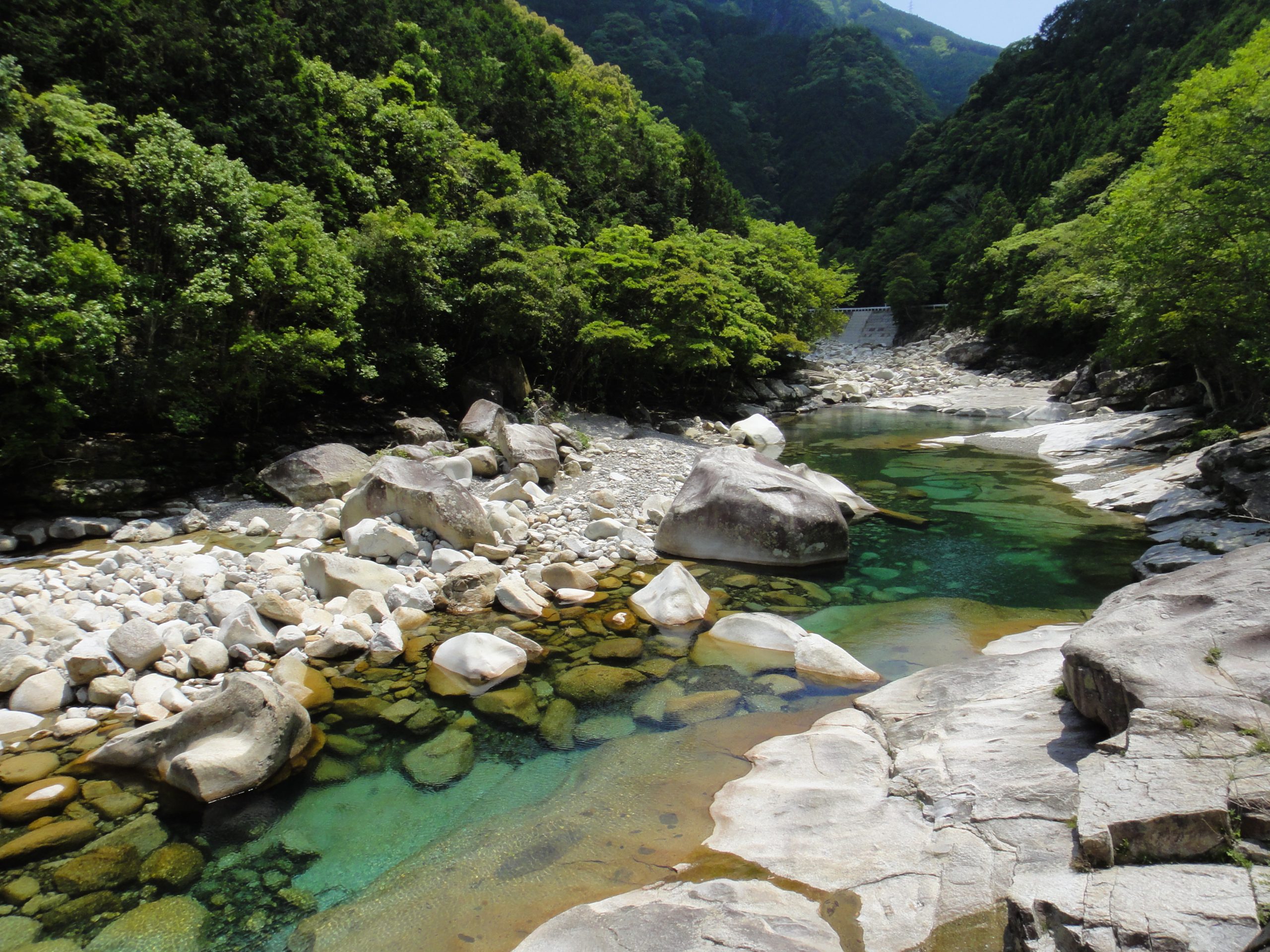
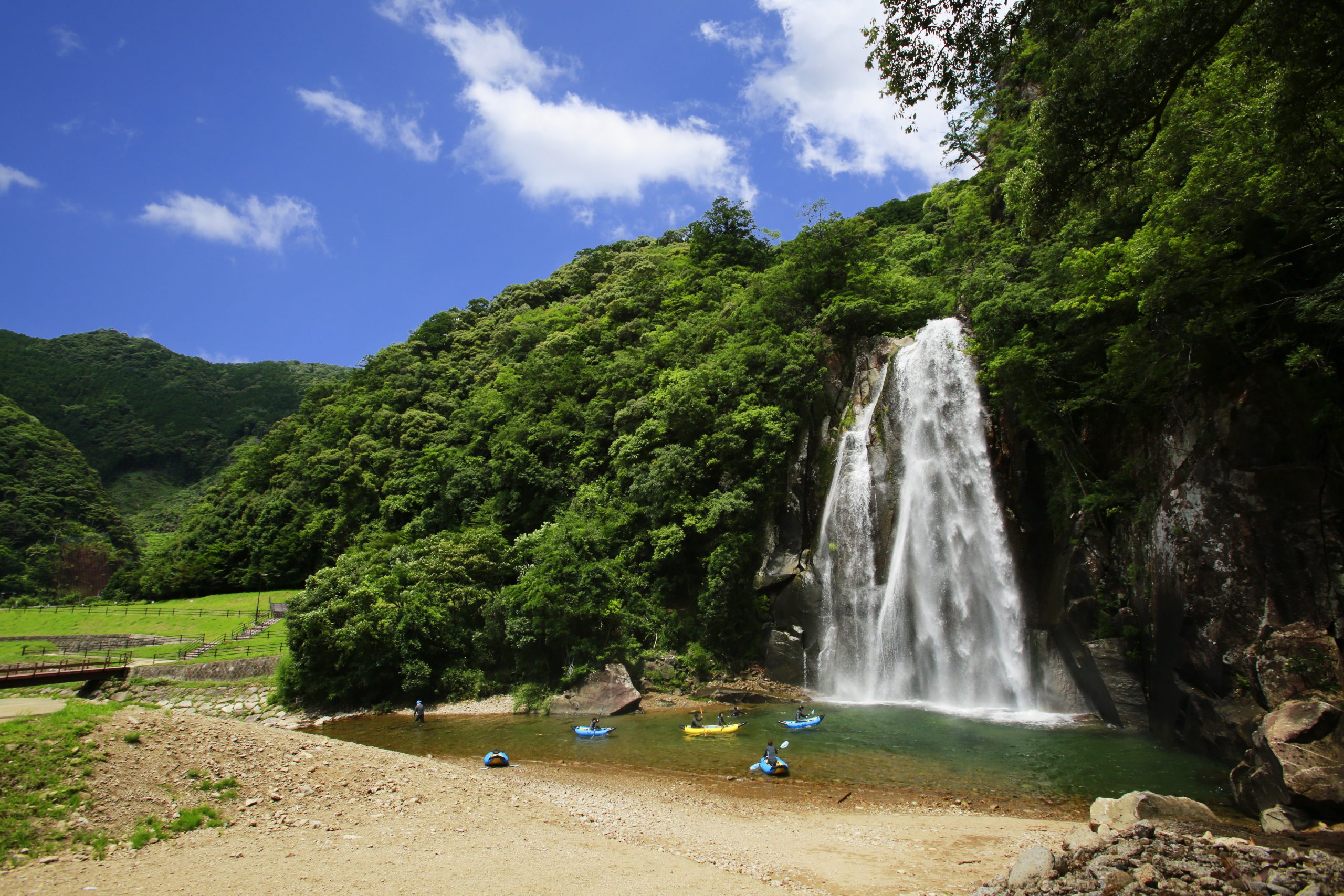
1 Choshi-gawa River [Kihoku-cho]
-300x200.jpg)
The Choshi-gawa River originates from Odaigahara, which experiences the highest annual rainfall in Honshu, and cascades down a steep slope of approximately 1,000 meters before emptying into the breathtaking Kumano-nada. The majority of the river’s flow originates from the mountainous regions, with few human settlements along its water basin, resulting in its crystal-clear and stunning emerald green appearance.
The river is sometimes referred to as the “Miracle River” due to its exceptional level of clarity.
Without having to dive, you can easily see observe the aquatic wildlife by merely putting your face in the river.
The Uotobikei Ravine, a tributary, is a rugged and rocky area dotted with boulders and unusual rock formations, making it a popular destination for leisure activities.
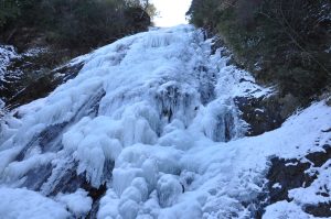
The flow of the river is approximately 17 kilometers long.
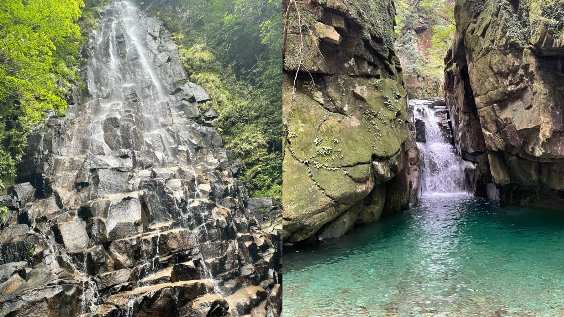
There are several waterfalls upstream, including Seigoro-taki Falls, known for its icefalls.
The Uotobikei Ravine, a tributary, is a rugged and rocky area dotted with boulders and unusual rock formations, making it a popular destination for leisure activities.
In the midstream of the river, there is a base for outdoor activities called “Camp Inn Miyama,” and many people come to the shallow and calm lower stream seeking relief from the heat.
The most distinctive feature of the Choshi-gawa River is its brackish water region referred to as the yurayura-tai, or swaying zone.
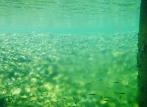
This estuary serves as a natural habitat for various aquatic creatures, including fish, and is distinguished by the clear division between the fresh river water and the saline seawater.
Although the separation of freshwater and saltwater, known as the “saltwater wedge,” is present in all rivers, it is particularly prominent in the Choshi-gawa River.
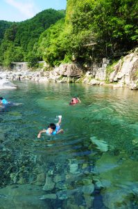
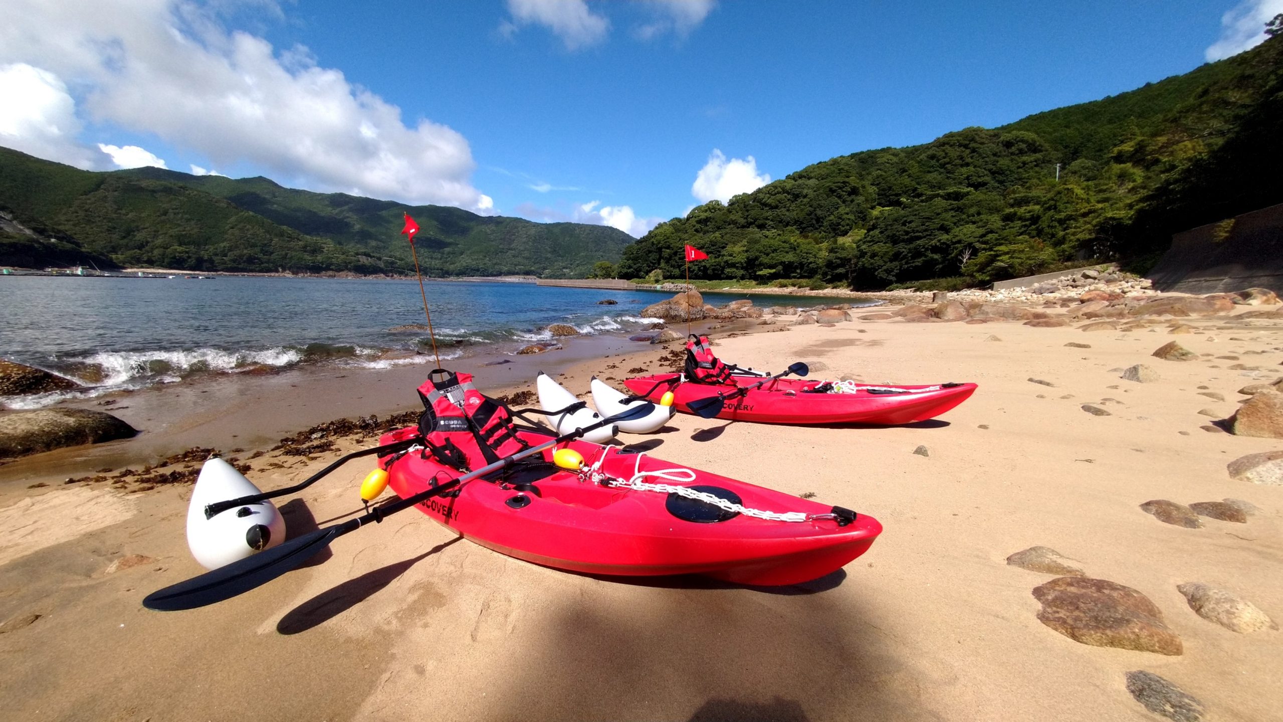
The residents living near the river basin have become familiar to the river by partaking in various activities such as fishing for sweetfish and amago, camping, swimming, playing Tarzan, and sliding down natural rock formations.
A variety of initiatives are being pursued at the Choshi-gawa River basin to ensure its splendor perseveres for the upcoming generations. This encompasses expanding the size of cleaning operations and monitoring the regional ecosystem.
2 Doro-kyo Gorge [Kumano City]
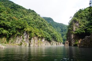
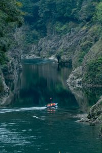
The Doro-kyo Gorge is a vast canyon that stretches across Nara, Wakayama, and Mie Prefectures within the Yoshino-Kumano National Park, and has been designated as a special scenic spot of national significance.
Located along the Kitayama-gawa River, a tributary of the Kumano-gawa River and one of the “100 Clear Streams of Japan,” it is a series of ravines sculpted by heavy rains and rapids, with crystal-clear water.
From the upstream, the gorge splits into the “Okutoro Gorge” and the “Shimodoro Gorge.”
The stunning display of massive boulders and unusual rock formations of the Shimodoro Gorge is referred to as “Doro-hatcho”.
The magnificent beauty of nature is exemplified by the picturesque display of lush greenery in spring and colorful autumn foliage, each capturing the essence of their respective seasons.
川の色は深みのある鮮やかなコバルトブルー。
The river’s deep, vivid cobalt blue hue is enhanced by the vibrant colors of the surrounding trees and the rocky surface of the cliffs, creating a mystical atmosphere.
One can admire the grandeur of the canyon from a sightseeing riverboat.
Why not take a peaceful and relaxing ride on the riverboat and enjoy the scenery?
The various expressions of the landscape here are truly captivating, making this a popular spot for professional photographers as well.
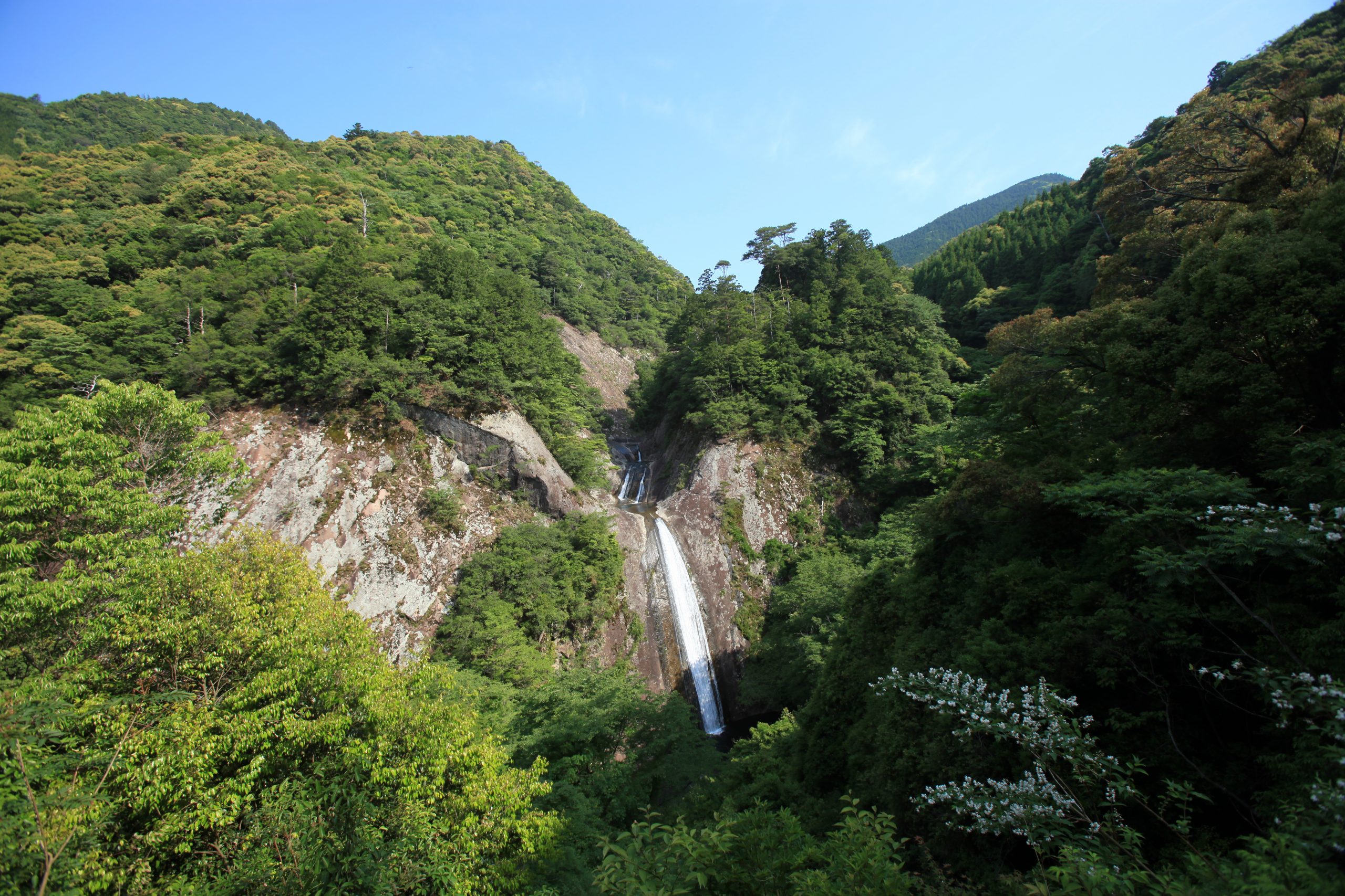
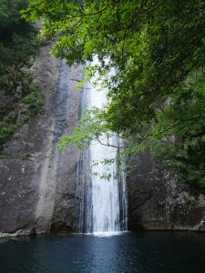
3 Nunobiki-no-taki Falls [Kumano City] 100 waterfalls of Japan
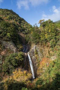
Located in Nunobiki Valley, a branch valley of the Yoji-gawa River, which is a tributary of the Kumano-gawa River, the Nunobiki-no-taki Falls boasts a height of approximately 53 meters and is recognized as one of the “100 waterfalls of Japan.”
The waterfall consists of four tiers, with the first being 12 meters, the second 3.5 meters, the third 7.7 meters, and the fourth having a drop of 29.1 meters into the basin.
The name of the waterfall comes from the way it flows down smoothly like a large piece of cloth hanging down.
This elegant waterfall, with no sound or splashes, has a unique atmosphere created by the sight of the clear water falling.
The flow of water is also known as Medaki.
Additionally, the surrounding forest is designated as the “Kirazu-no-Mori Forest Preserve,” where the abundant nature is protected.
エメラルドグリーンの滝壺付近まで、石段がつくられています。
Stone steps lead up to the vicinity of the emerald green basin of the waterfall.
In just a quick 5-minute walk from the road, you can reach the bottom and have a direct view of the lowest waterfall.
The tranquil flow of water disappearing into the basin is said to have a cleansing effect on the soul.
The Nunobiki-no-taki Falls, along with the Ara-taki Falls downstream, is also known for being a training ground for Shugendo (the “path of training and testing”).
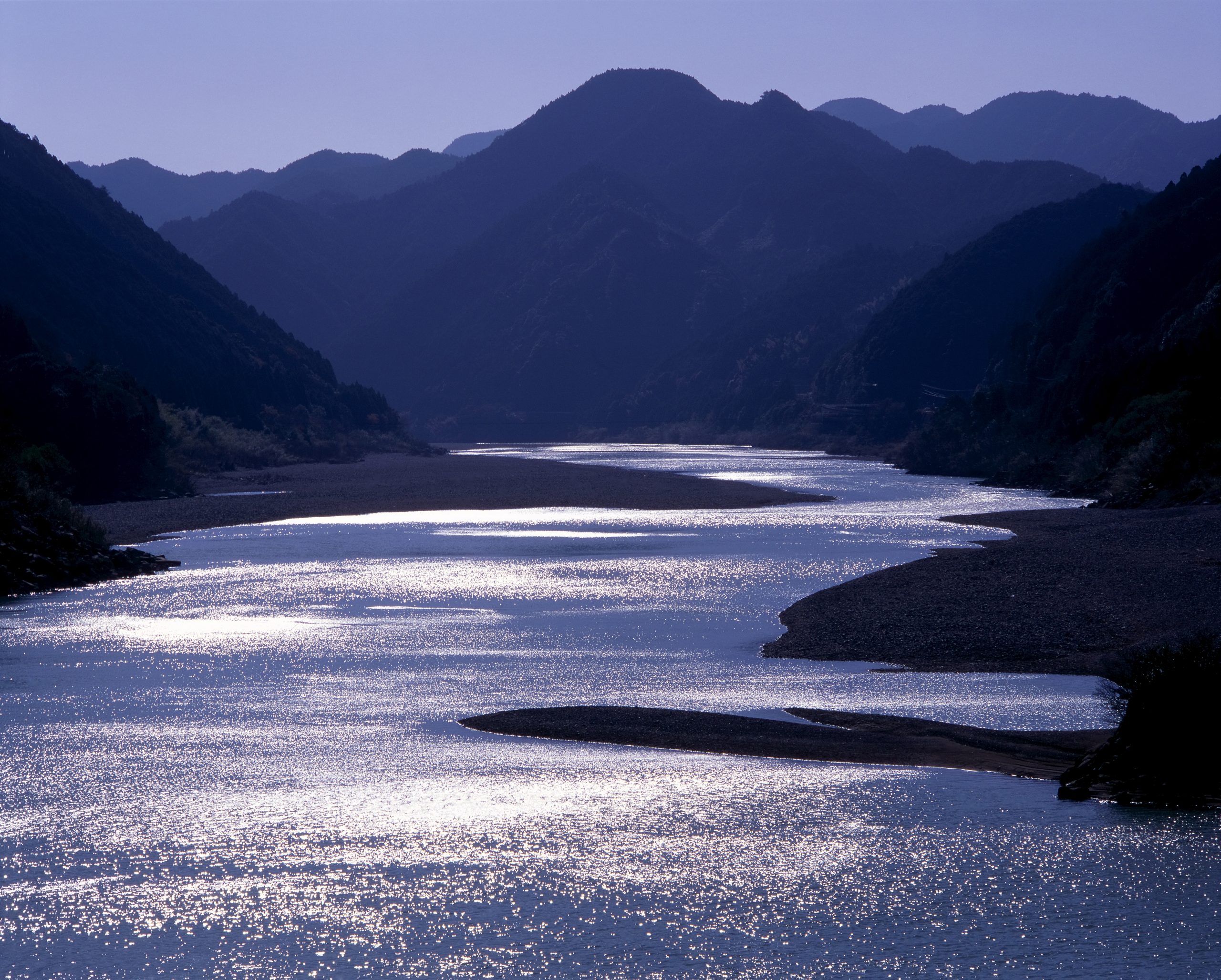
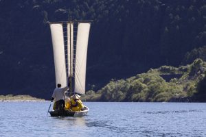
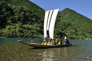
4 Kumano-gawa River [Kiho-cho] Kawa-no-Sankeimichi (River Pilgrimage Route) Santanbo
The Kumano-gawa River, acknowledged for its significance as a Kawa-no-Sankeimichi (River Pilgrimage Route), has been designated as a World Heritage site.
Historically, people who visited Kumano Hongu Taisha used to travel downstream on the Kumano-gawa River by riverboats to reach Shingu (Kumano Hayatama Taisha Grand Shrine).
It is even said that the Emperor and nobles during the Heian period utilized riverboats for their Kumano pilgrimage.
The Sandanbo, a boat with three sails, is a prominent sight on the Kumano-gawa River.
It was formerly used to transport charcoal, firewood, and rice downstream from the upstream area early in the morning, and then, around 10 am, catch the southern wind that began to blow and return upstream with the help of its sails.
The view of Sandanbo sailing back and forth was reportedly a common sight on the busy Kumano-gawa River with boats carrying goods.
The Sandanbo is unique to the Kumano-gawa River.
With a length of up to 8 meters, one might wonder why the boat is able to travel upstream on the river.
The answer lies in the warm winds brought by the Kuroshio (also known as Black or Japan Current), which blow into the river from the Kumano-nada, serving as the energy source for the boat.
Additionally, the wide river width and the steep mountains on both sides of the river are also crucial factors.
When these conditions are combined, Sandanbo gains speed and moves upstream egins to move quietly.
The sound of waves gently hitting the riverbed is delightful, accompanied by the melodies of birds singing from the forests along the river.
With the power of the wind, it’s a comfortable and eco-friendly way to observe the Kumano-gawa River in detail.
Don’t miss the chance to experience a Sandanbo tour, where you can immerse yourself in nature, surrounded by the beauty of the Kumano-gawa River and listen to the boatman’s stories, while reminiscing about the bustling past when boats were a common sight.
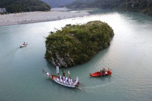
5 Mifune-jima Island [Kiho-cho] World Heritage Site
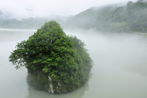
Mifune-jima Island is located about 2km upstream from the mouth of the Kumano-gawa River.
Although administratively it belongs to Kihoku-cho in the Minamimuro District of southern Mie prefecture, it is actually part of the precincts of Kumano Hayatama Taisha in the neighboring Shingu City, Wakayama prefecture.
It serves as a stage for the festival of Hayatama Taisha, the Mifune Matsuri (Festival).
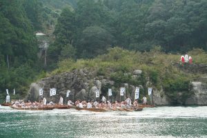
Once a year, the Mifune Matsuri is held, during which the Kumano-fusumino-okami deity is transported to and from the island on a Miyukibune (boat) and returned to the main shrine of Hayatama Taisha.
Numerous activities are held around Mifune-jima Island, including a competition involving nine Hayafune (boat) and the “Harahari dance,” where men dressed as women dance with oars on the Morotofune (boat).
These events aim to reenact the arrival of the Kumano-fusumino-okami deity.
A poem about Mifune-jima Island and its festival is found in the Fuboku Wakasho, a privately compiled anthology of poems from the late Kamakura period, indicating that the festival has a long history.
Additionally, a monument inscribed with the poem has been erected at a scenic viewpoint on the island.
“Mifune-jima Island emerges in the winding shores of Kumano.
The deity rows around the island during his comings and goings.”
— Gofukakusa-in no Shosho no Naishi